THE ONLY SLAM SYSTEM THAT MAINTAINS HIGH ACCURACY ACROSS HUNDREDS OF TRAJECTORIES AND KILOMETERS OF PATHS
→ Exceptional Photo Quality
→ Remarkable Accuracy
→ Unmatched Flexibility
— Professional 3D mapping
— Control points & control scans as constraints
— Desktop software included
— Full control of SLAM parameters
— No extra fee for data processing
— Digital Twin applications
Advanced 3D Reality Capture
Remarkable accuracy and exceptional photo quality
Digital Twin
Make it possible to control and manage your assets
Underground
Mines & Cavities
Great performance in dark and deep sites

3D Mapping
of Large Assets
Management of many social housing facilities
Free Sharing
Enjoy free tools for 3D and 2D data
Enjoy free tools for 3D and 2D data
Experience a 3D model navigation
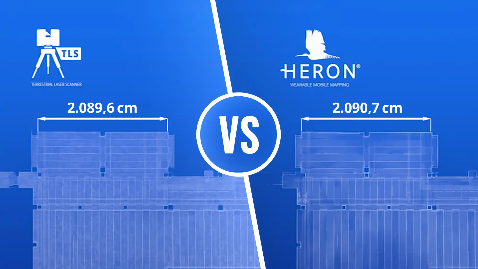
Benefit from HERON Accuracy
Compare HERON output with a TLS one
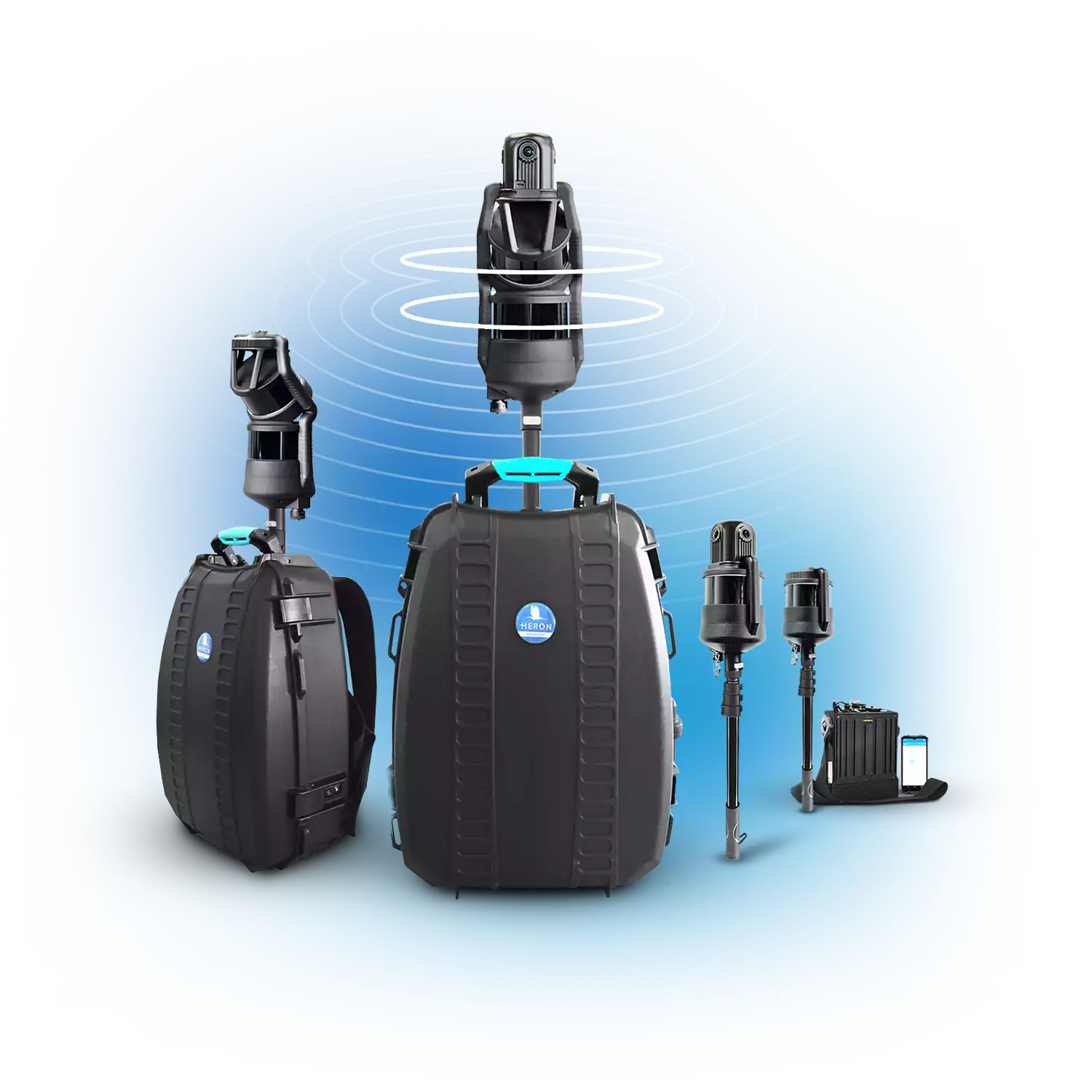
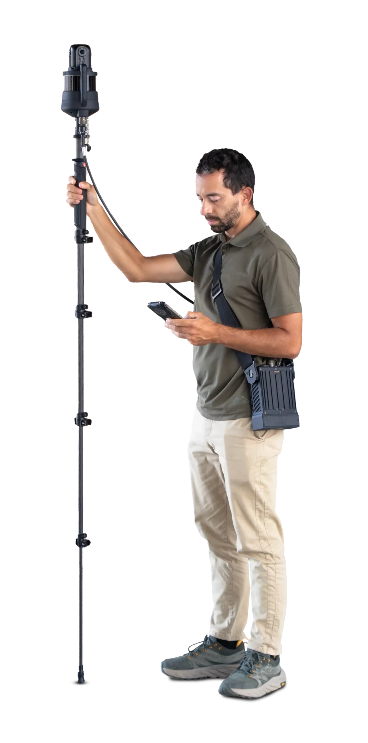
Versatility in your hands
No limits to your surveys, even the most extreme ones
Get in Touch
Our team is here for you!
Are you attending? Join our experts.


If you need more information or have business inquiries, please write to us.
Join our community
Keep updated
Join our community
Keep updated
Contents © Gexcel 2026. All rights reserved.
Gexcel srl • c/o CSMT Technology Hub – Via Branze 45, I-25123 Brescia (BS), Italy | VAT n. IT02943490983
To provide you with the best online experience, this website uses cookies • Privacy Policy • Cookie Policy