Common Issue with Mobile Mapping Data Exports—and How HERON Fixes It
With HERON, your exported datasets—whether RCP or E57—retain perfect alignment between panoramic images and 3D data. The result: accurate, efficient, and frustration-free navigation across platforms.
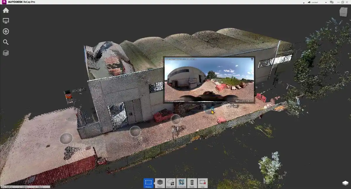
The Problem: Misaligned Panoramic Images
In mobile mapping, one of the most frequent challenges is the misalignment of panoramic images during data export. Even when RGB colorization is applied correctly to the point cloud, the panoramas often appear out of sync with the 3D data and trajectory.
Typical Issues with Misalignment
-
Panoramas appear offset or incorrectly oriented relative to the 3D data.
-
Navigation in third-party software (e.g., CAD, BIM, or cloud platforms) becomes confusing and less reliable.
-
Analyses that combine panoramas and point clouds may lose accuracy due to inconsistent spatial references.
Why It Matters
When panoramas don’t align correctly:
-
Users can’t confidently inspect or measure between images and the 3D environment.
-
Workflows become more complex, often requiring manual corrections or reducing data reliability.
-
The contextual value of panoramas for inspection, documentation, and reporting is significantly diminished.
How HERON Solves the Problem
HERON eliminates these issues with a precise and dependable export process:
-
RCP format: When exporting from Reconstructor, HERON ensures panoramas are perfectly aligned within the RCP file, referenced both to the trajectory and the point cloud.
-
E57 format: The same accurate alignment is preserved in E57 exports, keeping panoramic images correctly positioned in space.
The Benefits of HERON’s Approach
-
Seamless Navigation: Panoramas and 3D data remain in sync, ensuring smooth exploration in any compatible software.
-
Reliable Integration: Perfect alignment allows for trustworthy visual and spatial analyses.
-
Streamlined Workflow: No need for post-processing or manual fixes—saving time and avoiding errors.
Dependable Mobile Mapping Exports
With HERON, your exported datasets—whether RCP or E57—retain perfect alignment between panoramic images and 3D data. The result: accurate, efficient, and frustration-free navigation across platforms.
Choose HERON for mobile mapping you can trust—no misalignments, just clean, consistent results.
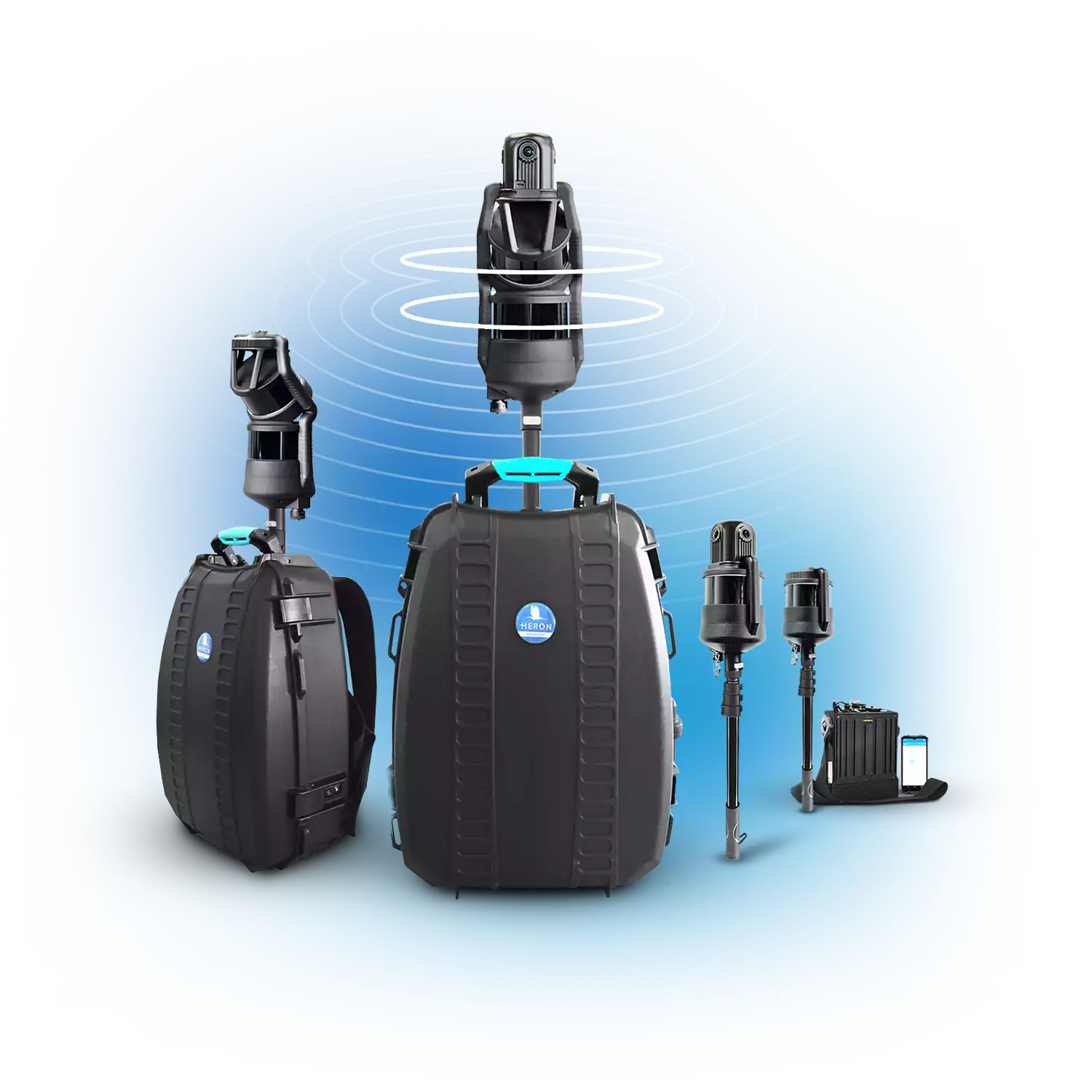
HERON—SLAM SYSTEMS
• Fast 3D mapping in any field
• 32-channel LiDAR sensors
• 300 meters max range
• 8K pano camera
• Advanced integrated software
• Geospatial and Digital Twin applications
HERON is developed under a licence of the European Commission Joint Research Centre
E. info@gexcel.it | P. (+39) 030 6595001
HEADQUARTERS
Via Branze 45, I-25123 Brescia (BS) ITALY